Need to escape the city? How about a refreshing day-walk in Hakone? Set out after breakfast, be back in time for dinner. Sneakers or hiking boots fine. Take a picnic. All for under ¥4000!
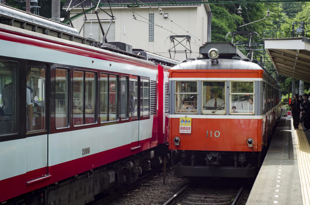
Begin on the wonderful Hakone Tozan railway. The bus is faster, but the railway is more relaxing. After the jangle of the urban railways, relish the view from three scenic switchbacks, while driver and conductor stroll an external catwalk to change ends.
Leave the train at Kowakudani Station, cross the main road and ascend the steep concrete road with the rustic sign pointing to Chisuji Waterfall and Mount Sengen. Turn left at another sign after about ten minutes. Shortly after the road levels out and sheds its concrete, you reach the falls. If you were expecting something spectacular, Chisuji Falls, with their majestic three-meter drop, will disappoint. Lovers of exquisite miniatures, however, will be charmed, the thousand strands of white water forming a delicate lace curtain to adorn the moss-covered rocks. Chisuji even means “thousand strands”.
Start the thirty-minute ascent by crossing the flat wooden bridge. After ten or fifteen minutes, turn left. The trail is clearly signed to Mount Sengen. From here on, the trail zig-zags up the steep northern flank of the mountain. In contrast to Fuji-san, the dome-shaped central mountains of Hakone get less steep the higher you climb; after twenty minutes of ascent, you will find the gradient easing off. There is even a mildly downhill section just before a junction, where the summit is clearly signed to the right. Now almost at the crown of the dome, the going is easy.
The grassy summit is well equipped with picnic tables and a bilingual signboard. An 804-meter peak would be a giant in some terrains, but in Hakone it is a small tyke, and the view is, regrettably, composed entirely of the higher mountains that surround it. These do, however, shade it from the worldly hullabaloo. On a quiet weekday, there are few more peaceful spots.
To begin the descent, follow the trail next to the sign board. If the two-hour descent to Yumoto Station seems daunting, there are two shorter trails leading to higher stations on the Hakone Tozan Line. The first (to Miyanoshita Station) occurs less than ten minutes below the summit. The second (to Ōhiradai Station) about half an hour later. Both are well signed.
The broad descending trail, as expected, increases in steepness as it loses altitude but, this side of the mountain being much less abrupt, there is a good hour of gentle descent before the steps and zigzags reappear. Even so, the ground can be slick and the use of at least one stick throughout the descent is recommended. About an hour and a half from the summit, there is a signboard marking the now invisible ruins of Yusaka Castle. From the bilingual signboard, we learn that we have been treading the Old Yusaka Road–for many centuries one of the key routes across Hakone.
As the trail continues its descent, the traffic gets louder, until a steep descent down a concrete-clad embankment dumps you on the busy main road leading northwards out of Yumoto town. Proceed carefully to the right until you reach a pedestrian bridge. Cross this, and you are at the top of Yumoto High Street, less than ten minutes’ walk from the station. Yumoto town, with its old resort vibe and copious cafés and souvenir shops, makes an ideal staging post on the way back to the frenetic swirl and rush of Yokohama.


